While we were strolling through the ONM, Dr. Rood took us to a ravine that had been eroded by creek that swelled with rain water. In this ravine, we saw a very large turtle, and a fellow student found a box turtle. The large turtle appeared to be snapping turtle, from where I stood. I have had several encounters with snapping turtles. When i was in elementary school, Snapping turtles would crawl up the driveway when it rained. Dad would catch them in 15 Gallon drums, put a rock on their back so they couldn't knock the barrel over and then give them to friends to make turtle soup. When I was a camp counselor, We found a snapping turtle in the creek, I caught it and held it up for pictures.
This is the link to that picture of me with the turtle:
http://www.facebook.com/media/set/fbx/?set=a.5535122460.12271.527767460#!/photo.php?fbid=5535667460&set=a.416871737460.205504.527767460&type=1&theater
Here is a link to some general information about Snapping turtles:
http://en.wikipedia.org/wiki/Common_snapping_turtle
Hope you find snappers as interesting as I do!
BAF
Tuesday, April 19, 2011
Tuesday, March 29, 2011
10 Fun facts about water
1) 70% of a Human Adult's body is made up of water
2) 70-75% of the earths surface is covered in Water
3) By the time a person feels thirsty, his or her body has lost over 1 percent of its total water amount.
4) The total amount of water on the earth is about 326 million cubic miles of water.
5) Less than 1% of the world’s fresh water (or about 0.007% of all water on earth) is readily accessible
for direct human use
6) 3.9 trillion gallons of water are consumed in the United States per month
7) The human body is more than 60 percent water. Blood is 92 percent water, the brain and muscles are 75
percent water, and bones are about 22 percent water
8) Three-quarters of the Earth's surface is covered with water, yet 98 percent is salt water and not fit for
consumption. Less than one percent of all the water on Earth is freshwater available for human
consumption.
9) In a 100-year period, a water molecule spends 98 years in the ocean, 20 months as ice, about 2 weeks in
lakes and rivers, and less than a week in the atmosphere.
10) An acre of corn will give off 15,000 litres (4,000 gallons) of water per day in evaporation
Sources:
http://www.allaboutwater.org/water-facts.html (#1-4)
http://water.org/learn-about-the-water-crisis/facts/ (#5)
http://www.waterinfo.org/resources/water-facts (#6-8)
http://www.lenntech.com/water-trivia-facts.htm (#9-10)
Wednesday, March 2, 2011
Make-Up from Seminar.
So when Mr. Tony Rojas came to speak at Mercer I was unable to attend because I had to attend a class at Macon State. As a makeup assignment I am writing about waste water treatment and how waste water is purified and cleaned so that it can be consumed by humans and other creatures.
The treatment plant that I am familiar with was very small scale, and very simple. The raw sewage was piped into the plant and held in a tank. The sewage was then pumped into the grinders where it was ground up and mixed in with a large amount of water, it is ground on a regular schedule for several hours and then pumped into a second holding tank where it is held and it allows for bacteria to eat the waste. From there it is moved to another tank and chlorinated which is the final step in the process. Samples are gathered on a regular schedule to be sent for tests. The water is then considered clean and can be released into a free flowing creek. This is a very primitive set up that I am slightly familiar with. there are much more sophisticated and highly technological systems out there. This link can give you a more specific explanation of the process:
http://en.wikipedia.org/wiki/Sewage_treatment
Munsell Soil Chart
When Scientists work with dirt and they need to know what combinations of other soils are combined to make the dirt they are working with they use the Munsell Soil chart. This chart helps them to identify what soils are present. They use the color of the soil to identify hue and chroma.
There are 12 soil orders found on Planet Earth. This website describes them: http://soils.cals.uidaho.edu/soilorders/orders.htm
Another method of identifying soil is by using the soil texture dichotomous key. This is a step by step flow chart that asks a series of questions and depending on the answer to those questions it will give a soil type or send you to another question in the chart that will help the user identify the soil.
This is an example of a Soil Texture Dichotomous Key: http://www.landhelp.info/documents/DichotomusKey6.pdf?PHPSESSID=f78117b04cbe1d39e82c3dc3cf85cf1e
The most prominent Soil type in GA is Inseptasol. It is pictured below.

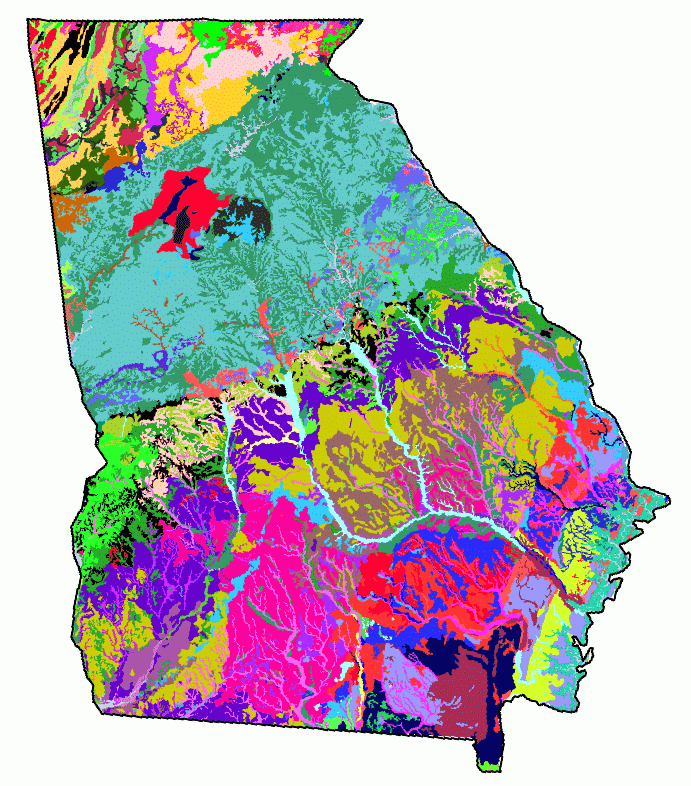
Here is a Map of the Soil in GA:
There are 12 soil orders found on Planet Earth. This website describes them: http://soils.cals.uidaho.edu/soilorders/orders.htm
Another method of identifying soil is by using the soil texture dichotomous key. This is a step by step flow chart that asks a series of questions and depending on the answer to those questions it will give a soil type or send you to another question in the chart that will help the user identify the soil.
This is an example of a Soil Texture Dichotomous Key: http://www.landhelp.info/documents/DichotomusKey6.pdf?PHPSESSID=f78117b04cbe1d39e82c3dc3cf85cf1e
The most prominent Soil type in GA is Inseptasol. It is pictured below.
Here is a Map of the Soil in GA:
Tuesday, February 22, 2011
Extremophiles
There are creatures in the sea called Extremophiles they live along hydrothermal vents on the ocean floor. This organism uses chemosynthesis through small bacteria that lives inside the tube worm in a symbiotic relationship. The hydrothermic vents on the ocean floor release hydrogen sulfide and extremely hot water. The bacteria that lives inside the tubeworm processes the Hydrogen sulfide and makes it useable for the tube worm.

Here is a picture of a tube worm.
Here is a picture of a tube worm.
Tomato Plant
So last tuesday morning the 15th of February, we were given a cup, seed, and soil. We were told to grow the plant. Since the weather had been fairly cold at night i kept it in my bathroom with the light on all the time. I poked a hole in the bottom of the cup to allow excess water to drip so i couldnt drown the plant on accident. I kept the soil moist, and when it was nice outside, I put it on our porch where it has stayed. I have not seen any sprouts, however, it takes 7-10 days to germinate. If i do not see any sign of life by thursday, I am going to assume the seed died.
Geology-Rocks
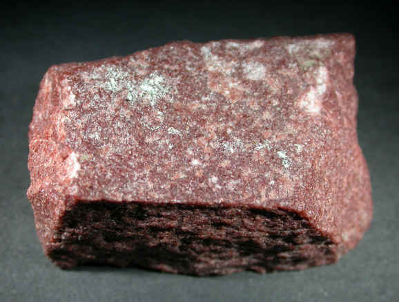
Igneous Rock: Is a rock formed from crystaslline minerals solidified from molten magma from deep in the earths interior. Examples are: basalt, rhyolite, andesite, lava, and granite.

Above is an example of Granite.
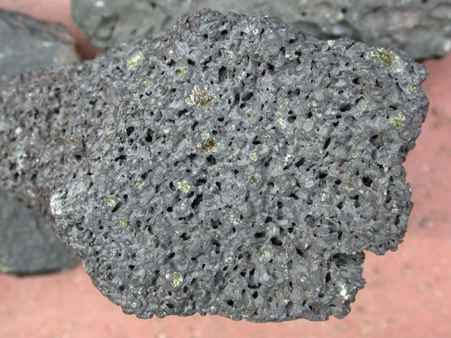
Above is a picture of Basalt
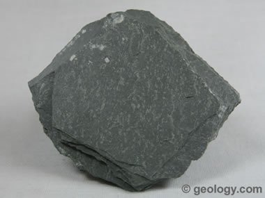
Metamorphic Rocks: are combinations of igneous and sedimentary rocks modified by heat, pressure and chemical reactions. Examples are Schist, and quartzite.

Schist
Quartzite
Sedimentary Rocks are: Deposited material that remains in place long enough or is covered with enough material to compact into stone. Examples are shale, sandstone breccia and conglomerates.
Shale

Sandstone
Above is an example of Granite.
Above is a picture of Basalt
Metamorphic Rocks: are combinations of igneous and sedimentary rocks modified by heat, pressure and chemical reactions. Examples are Schist, and quartzite.
Schist
Quartzite
Sedimentary Rocks are: Deposited material that remains in place long enough or is covered with enough material to compact into stone. Examples are shale, sandstone breccia and conglomerates.
Shale
Sandstone
Tuesday, February 8, 2011
Geocaching
Geocaching is a fun activity where individuals find small objects and record there travels. Some bigger caches have large things that the individual takes to another cache. They follow the GPS to find these locations. http://www.geocaching.com/ is the link to their site.
Geocaching helps the environment because individuals traverse the terrain and see all kinds of interesting things, and it makes them aware of the environment.
When we did our geocaching we walked .25 miles around the library and Willett Science Center. This is what we found on our quest around campus.
Point #1 Black Cylinder with Log
Point #2 Pill bottle with Black Eye Peas
Point#3 Red Cylinder with Log
Point #4 Hot sauce in Pill Bottle
Point #5 Soda tabs in Pill Bottle
Point #6 Chalk in Pill Bottle
Point #7 Battery in Pill Bottle
Point #8 Magnet with little car in Pill Bottle
Tuesday, January 25, 2011
Blog Assignment #2
Follow this link to find out about the Toolik Field Research Station in Fairbanks Alaska. http://toolik.alaska.edu/ If I were to go work at a Field Research Station, I would go to this one because I have always been fascinated with the Alaskan Wildlife and this would be a great place to go to study that.
A national park that interests me is the Denali national Park in Alaska. The landscape there is beautiful and it is home to the highest point in the USA: Mt. McKinley. Mt McKinley is the geologic feature that interests me. I have seen Mt Ranier in Washington state, and it is not nearly as high as Mt. McKinley. Mt Ranier was 45-60 minutes away from where I was in Washington and it towered above everything. I think it would be absolutely amazing to see Mt. McKinley towering even higher above the landscape. Here is a link to a Pic of Mt. McKinley: http://nature-reserves.net/?p=495
This Pic is one that I took while in Washington of Mt. Ranier:
http://www.facebook.com/photo.php?fbid=411114032460&set=a.411113342460.197834.527767460
I can't really pick a favorite animal that I would like to study, because I am so interested in so many of them. All of them large animals, and all of them are hunted. but since we are sticking with an Alaska theme, the animal that interests me at this present moment is the Grizzly bear. They are so huge and powerful, I would love to have the opportunity to hunt them one day.
Check out this link: http://animals.nationalgeographic.com/animals/mammals/grizzly-bear/
Wednesday, January 19, 2011
Other Maps for the assignment

This is a map of the whitetail deer density across the US. It is a cheropleth map.

This map is a combination of a proportional symbol map and a cheropleth map illustrating the elk harvest in idaho.
Tuesday, January 18, 2011
Map I made

Subscribe to:
Comments (Atom)